Mahone Bay Living Shoreline
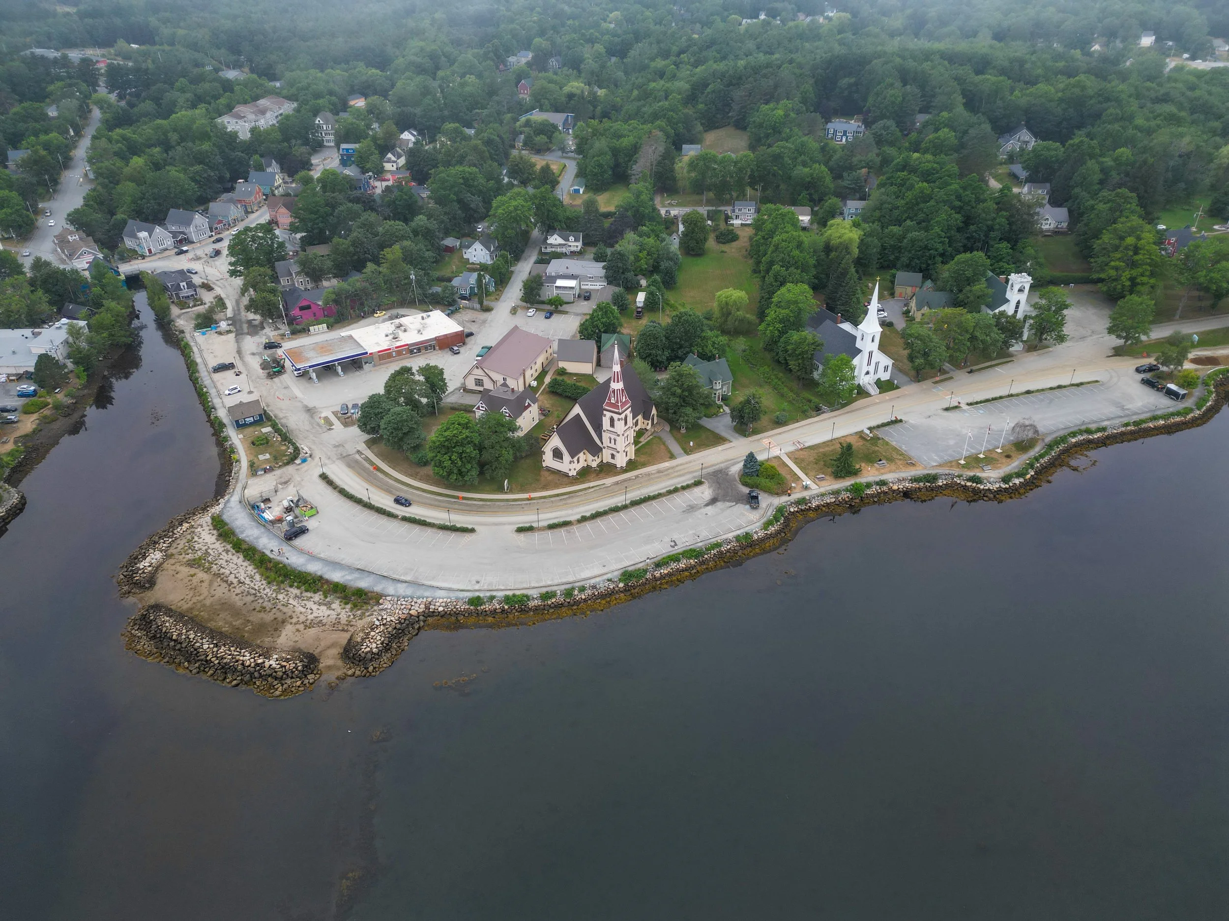
The Town of Mahone Bay, Nova Scotia, is extremely vulnerable to the effects of climate change, including sea level rise, storm surge, and increased precipitation. These effects result in flooding, coastal erosion, and an increase in contaminated stormwater runoff entering the harbour.
To help protect Mahone Bay from flooding and mitigate coastal erosion, Coastal Action proposed the 'Flood Protection and Shoreline Stabilization Project', better known as the ‘Living Shoreline’. This project builds on the conceptual designs produced by CBCL in 2016 in the Flood Prevention and Shoreline Enhancement Plan.
Check out the video below to learn how to navigate the Mahone Bay interactive flood map made by 3D Wave Design that highlights the living shoreline project.

Living Shoreline Components
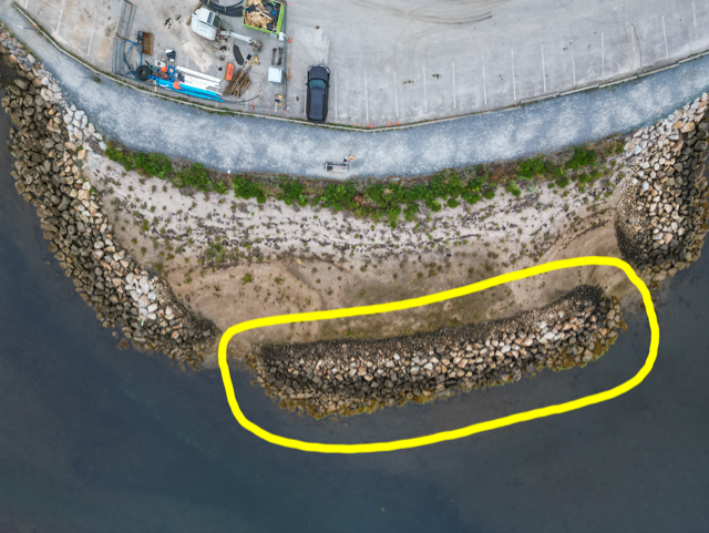
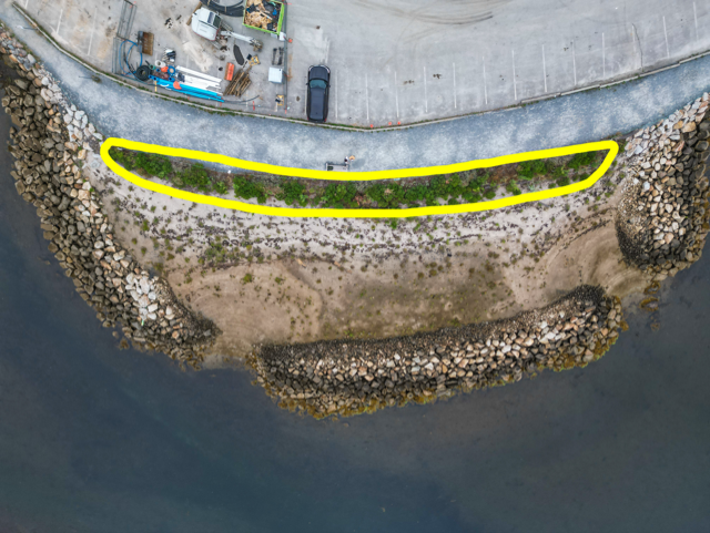
Rock Sills
A hard engineering structure that runs parallel to the shoreline. Rock sills help reduce wave energy and storm surge impact.
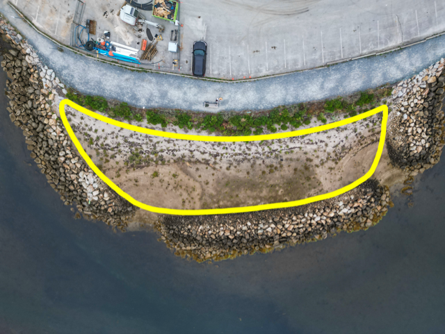
Tidal Wetland
Fills the area between the rock sill and the shoreline with planted native species. Tidal wetlands naturally filter stormwater runoff and reduce storm surge and wave energy. They additionally create valuable coastal habitat for fish and bird species.
Vegetated Bank
Graded areas planted with native shrubs and herbaceous perennials. Vegetated banks help to stabilize the soil.
The Living Shoreline is expanding!
See our Project Update Page for details!
Project Funders
This project is supported by the Sustainable Communities Challenge Fund, delivered by the Nova Scotia Federation of Municipalities on behalf of the Province of Nova Scotia.
The pilot demonstration site has been generously sponsored by Intact Financial Corporation.

Project Partners
Funded in part by the Government of Canada.


This project is supported by TD through the TD Ready Commitment.